
I had been wanting to go see the Hondoo Arch in central Utah for 20 years
or more. For some reason, it has
been shown for decades on just about any road map of Utah you ever see, in spite
of the fact that they hardly show any other arches anywhere, and that there is
no way to get there without taking 60 miles of dirt roads, which aren’t even
shown on the maps at all. Why put it on
a road map if you can’t get there? So
I decided I would, anyhow. I had
plotted out, for hours, the exact route by looking down at the area of the San
Rafael Swell in Google Earth, and printed out four large 11x17” maps of the
terrain with all the landmarks showing (various hills, buttes, and canyons). So,
with a full tank of gas, I took off from Green River.
I hadn’t taken my new truck out on any real 4-wheel-drive outings since
I got it over a year ago, so I was looking forward to some really crummy, muddy,
sandy, bumpy, rocky, washed-out, pot-holey roads in the utter boondocks.
I expected to be lurched side-to-side and up and down for hours, with
many a crunch and crash of the wheels and axles, causing sore arms on the
steering wheel and sore belly muscles from all the wild tension of just hanging
on for the ride. But no – the dirt
roads were quite disappointingly smooth! I
was blatting along at 50 miles an hour for half of the trip.
Any kind of car could make it. There
was only one short area where the road actually got scary and a bit dangerous,
clinging to the side of a cliff with a dropoff to the left.
And I will never manage to get all the dust out of the truck – you
could write your name with your finger on the dashboard.
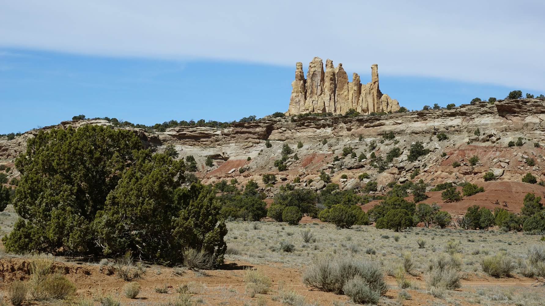
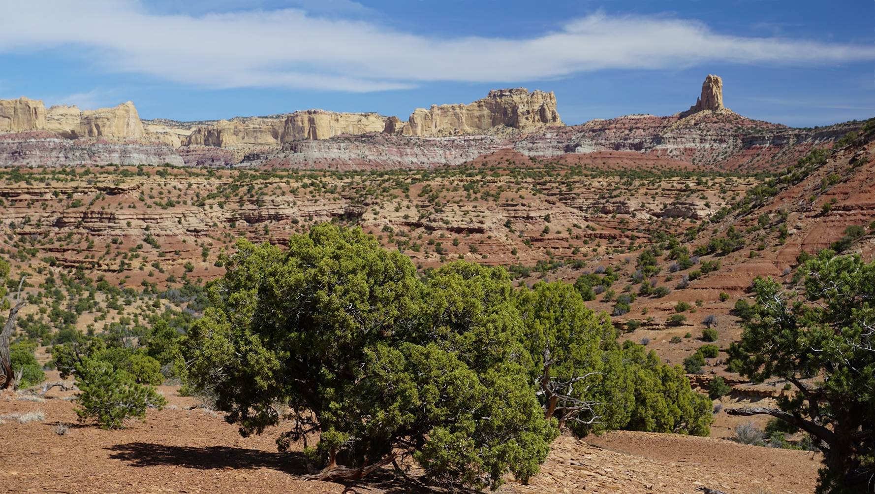
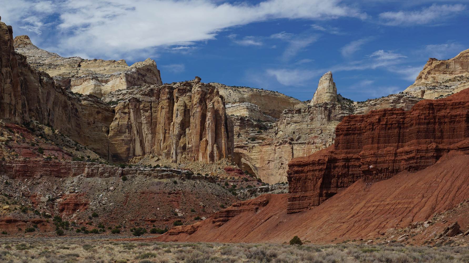
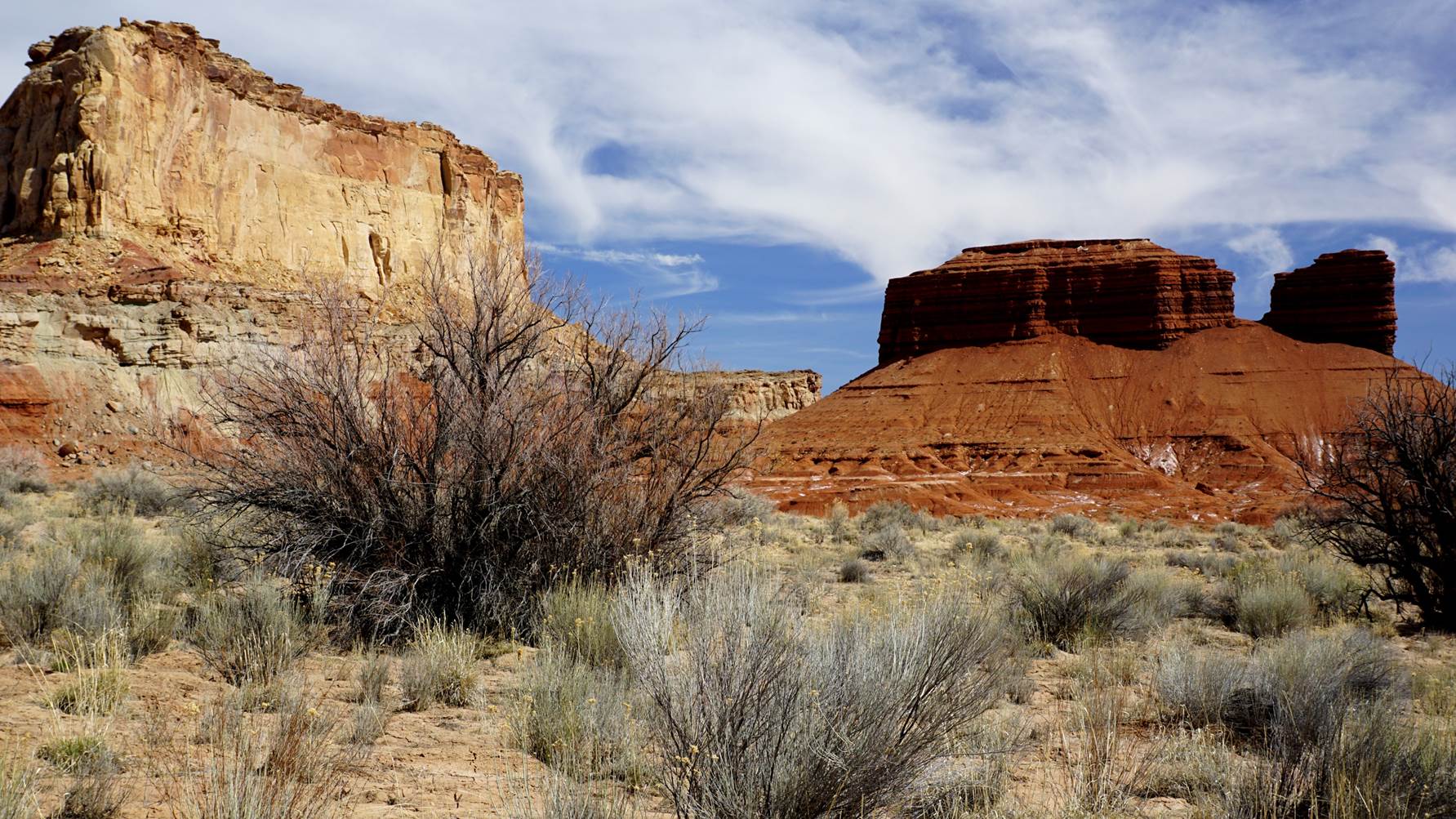
But what I didn’t expect, was what glorious scenery I had discovered!!
The San Rafael Swell, which is a huge, long, uplifted ridge of rock, is
perhaps the one place in the US most often mentioned as a candidate for a future National
Park. I had been in parts of it
before, most notably on one of the longest, most exhausting hikes I ever took,
to see the practically unknown Mystery Arch (I decided it should be called the
Misery Arch instead). But I had
never seen the canyons to the west of the main upheaval ridge.
It has everything one could wish to have in a national park!
It would certainly be worthy of the name, which is more than I can say
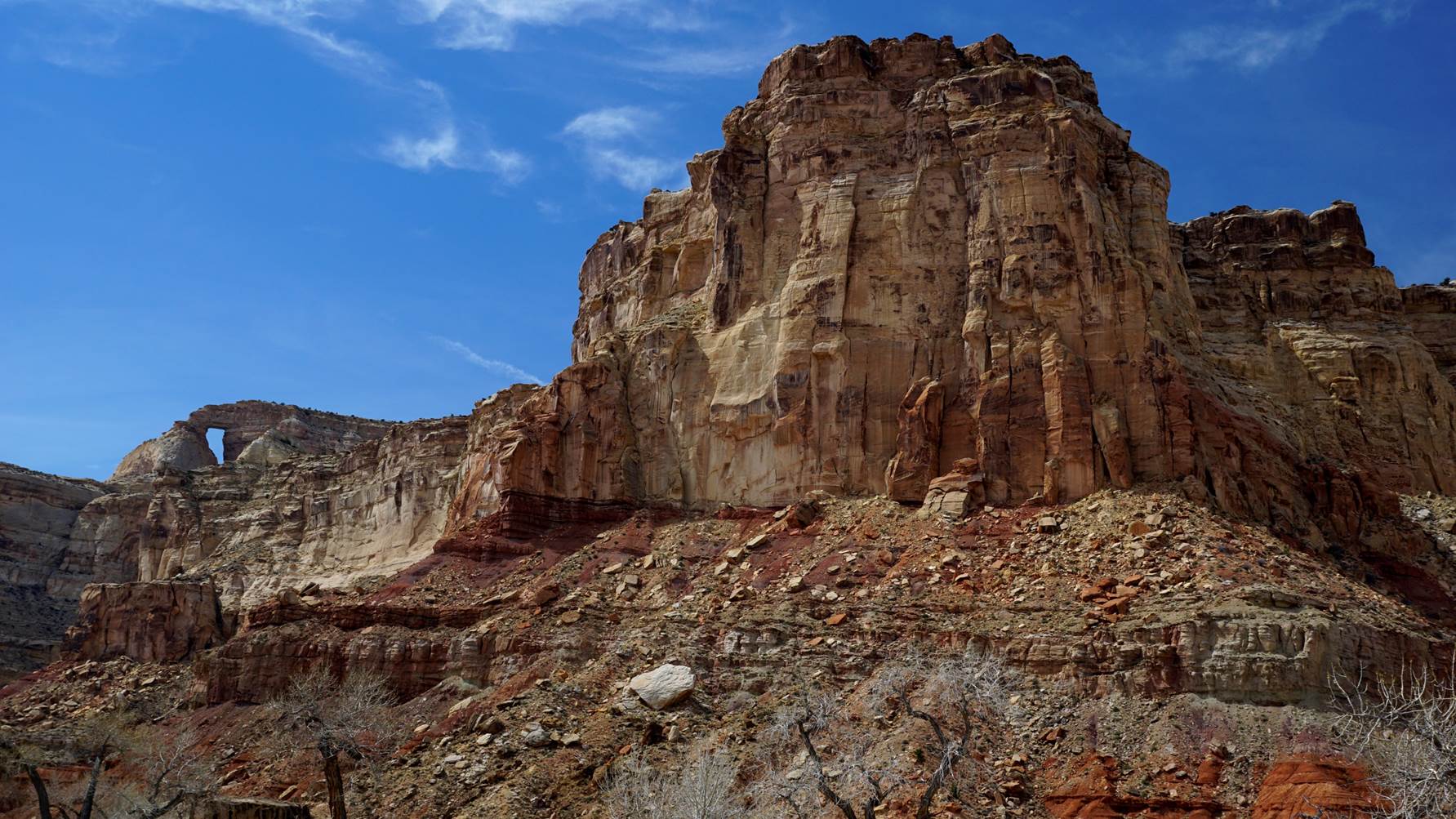
for a few others that already are national parks (as in Death Valley.) I drove from one
magnificent view to another. I
wasn’t planning to take any pictures till I got to the Hondoo Arch – but I
took about 80. The great thing about
it was, there was not one thing as far as one could see that was made by the
hand of man! It was as pure and
natural (except for the skinny dirt road I was on) as it had been since the days
of the Indians, or the many millennia before that.
Not a building, not a fence, not a telephone pole.
I didn’t even pass another car or human the whole way in.
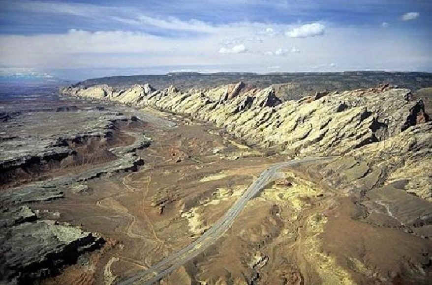
I
didn’t take this picture from the air, obviously – but it shows the massive
slanted rock ridge of the Swell,
the highlands behind it where I went, and the interstate freeway that they
hacked right through it!
I hope they don’t national parkerize it though, ever. Of course that would protect it from ever getting houses built on it, or Walmarts or McDonald’ses; but it would bring paved roads, visitor centers, parking lots, sidewalks, warning signs, garbage cans, picnic tables, guard rails, campgrounds, restrooms – and a million people a year to see it. I am glad there is still at least one fabulous scenic area left in the country just for us real nature nuts to discover, untamed and unspoiled, like the San Rafael Swell – a place that only hardcore outdoor lovers will find and explore. I don’t mean that little families from Peoria should be excluded, not at all – but most wouldn’t want to make the effort, or get their cars all dirty. To me, the effort to get there makes it all the more special, and I can vacuum out the dust.
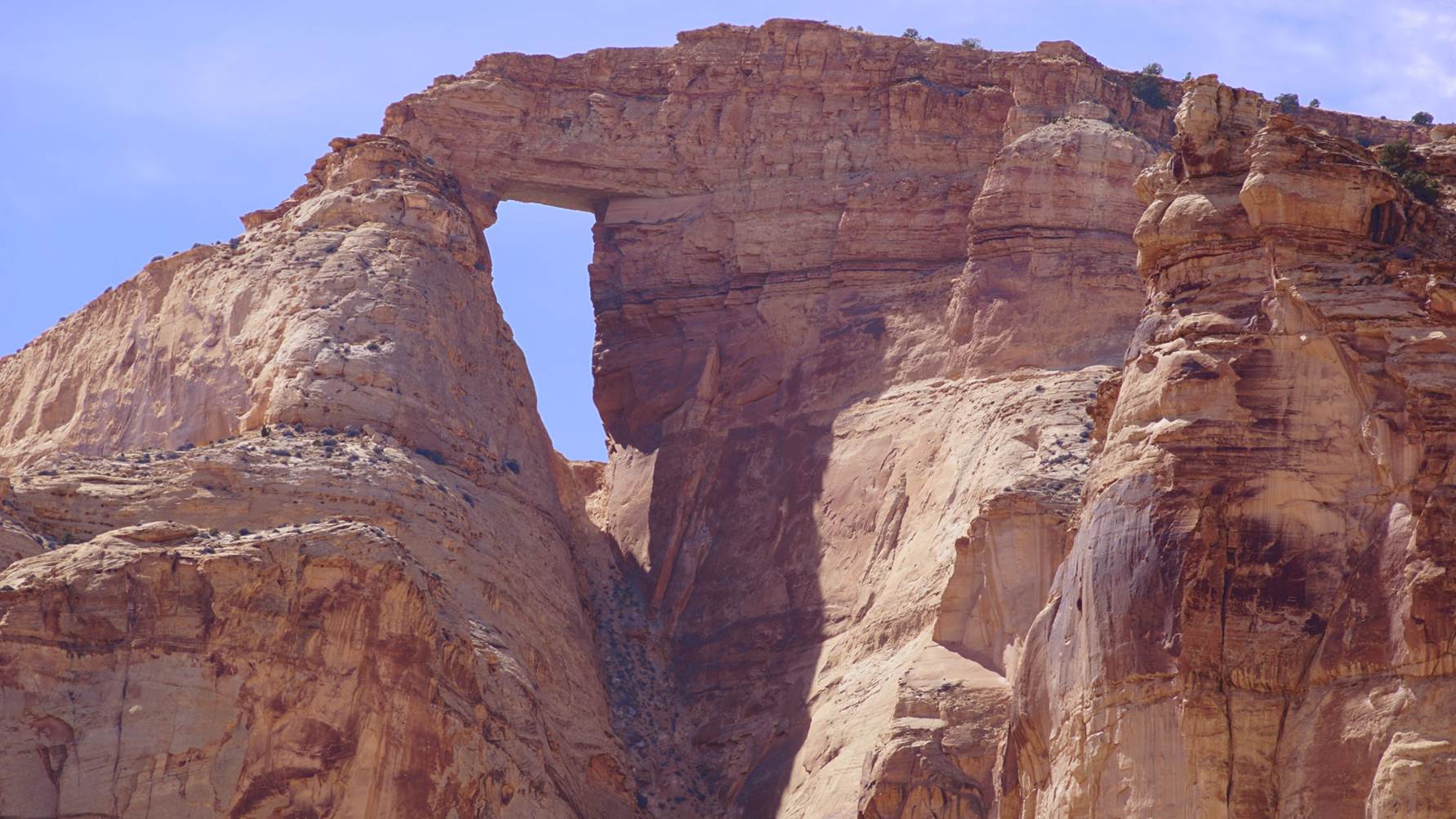
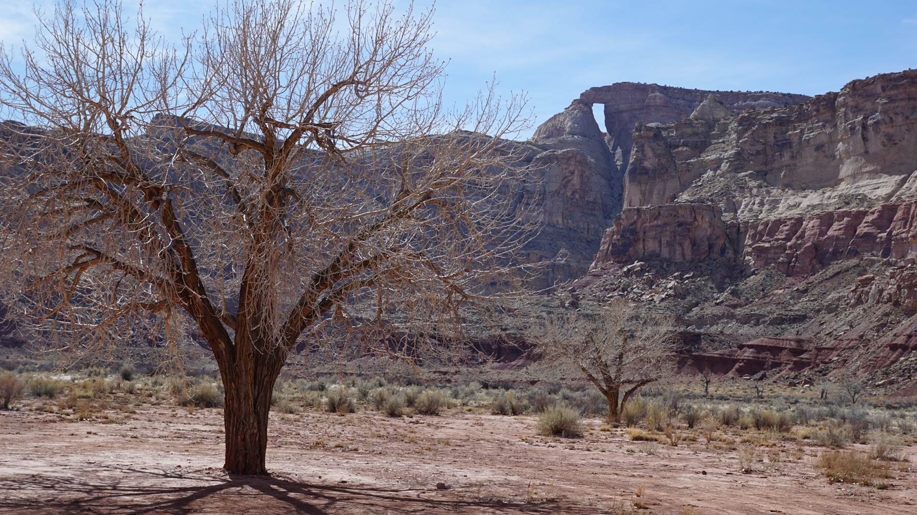
After going around one sharp bend, finally, for a few seconds, the Hondoo came into view. I let out a big yeehaw!! After all these years, I was there! Almost – it disappeared again behind a cliff, but I knew I was close now. There is no chance of not finding it, such as some other goose chases I have been on looking for arches and natural bridges – this one is clear at the top of a ridge, and visible for miles. I drove as close as I could, right at the edge of what I found out later was quite appropriately known as Muddy Creek – and got totally bogged down in the sand. That was the only time of the whole day where I had to put the truck in 4-wheel drive, but I got unstuck.
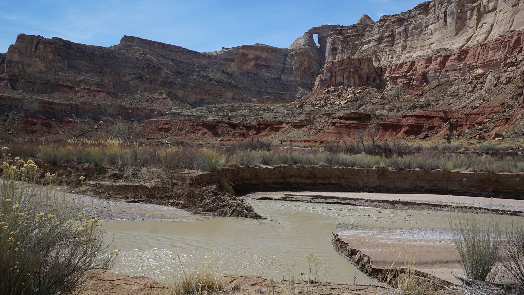
I
made it!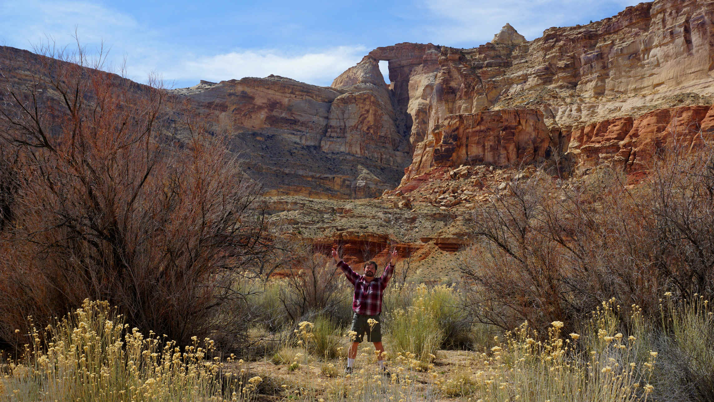
The Hondoo doesn’t look really big, since it is so high, but I am sure
from inside that it seems massive – the inside is as high as a 6-story
building. It faces east, so by the
time I got there, the sunlight was almost past it; I have already decided to go
back again, camp out, and get early morning shots!
But I definitely have no big desire to climb up inside it – that steep
sandy slope right under the opening is the kind of wretched incline where one
step forward causes you to slide about three steps back.
I wouldn’t mind trying to walk across the top, though….
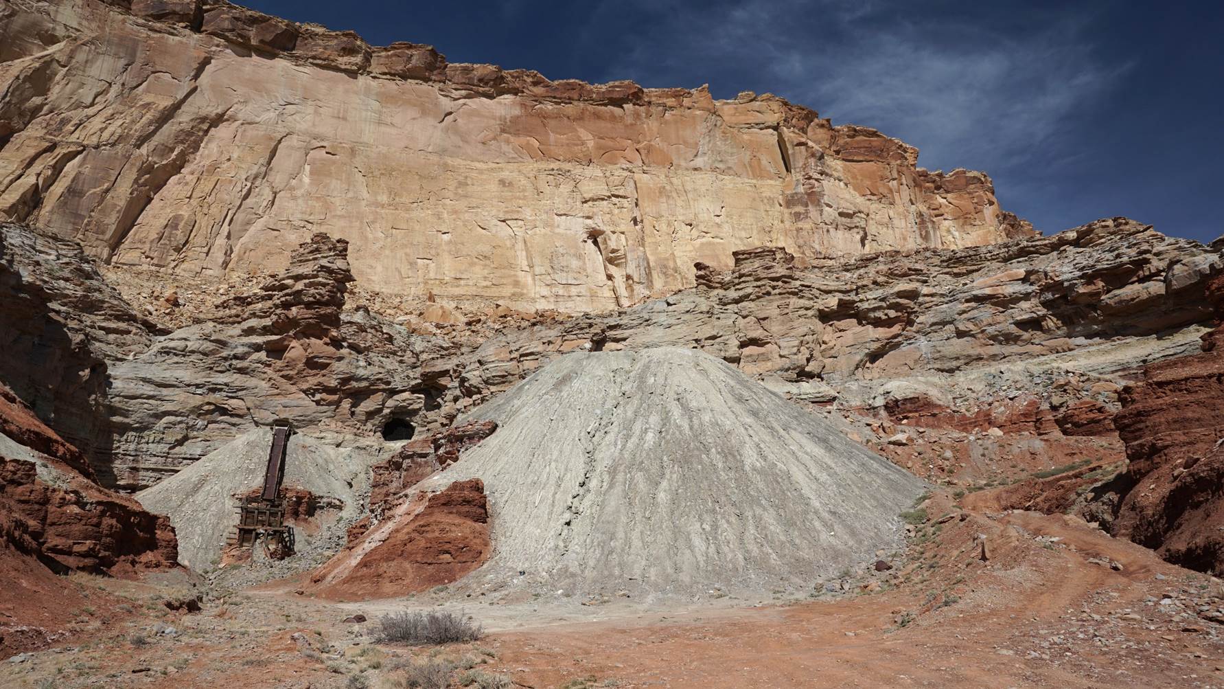
I took a totally different route on the way back out, and discovered the
ruins of an old uranium mine. I
found out that a hundred years ago, so much uranium had been found there that a
town of 450 people had existed right in sight of the Hondoo Arch!
You would never know it now, hardly a trace of it was left, which was
great for the scenery; there was only the old machinery shown below, well-hidden
around a bend in a cliff. In fact,
the uranium ore was of such fine quality that Marie Curie, who did the first
major studies of radioactivity in uranium (and was the first woman professor at
the Sorbonne, and won two Nobel Prizes), came all the way from France to this
very area to see where the ore came from.
The
black hole just to the right of the machine is the entrance to the mine:
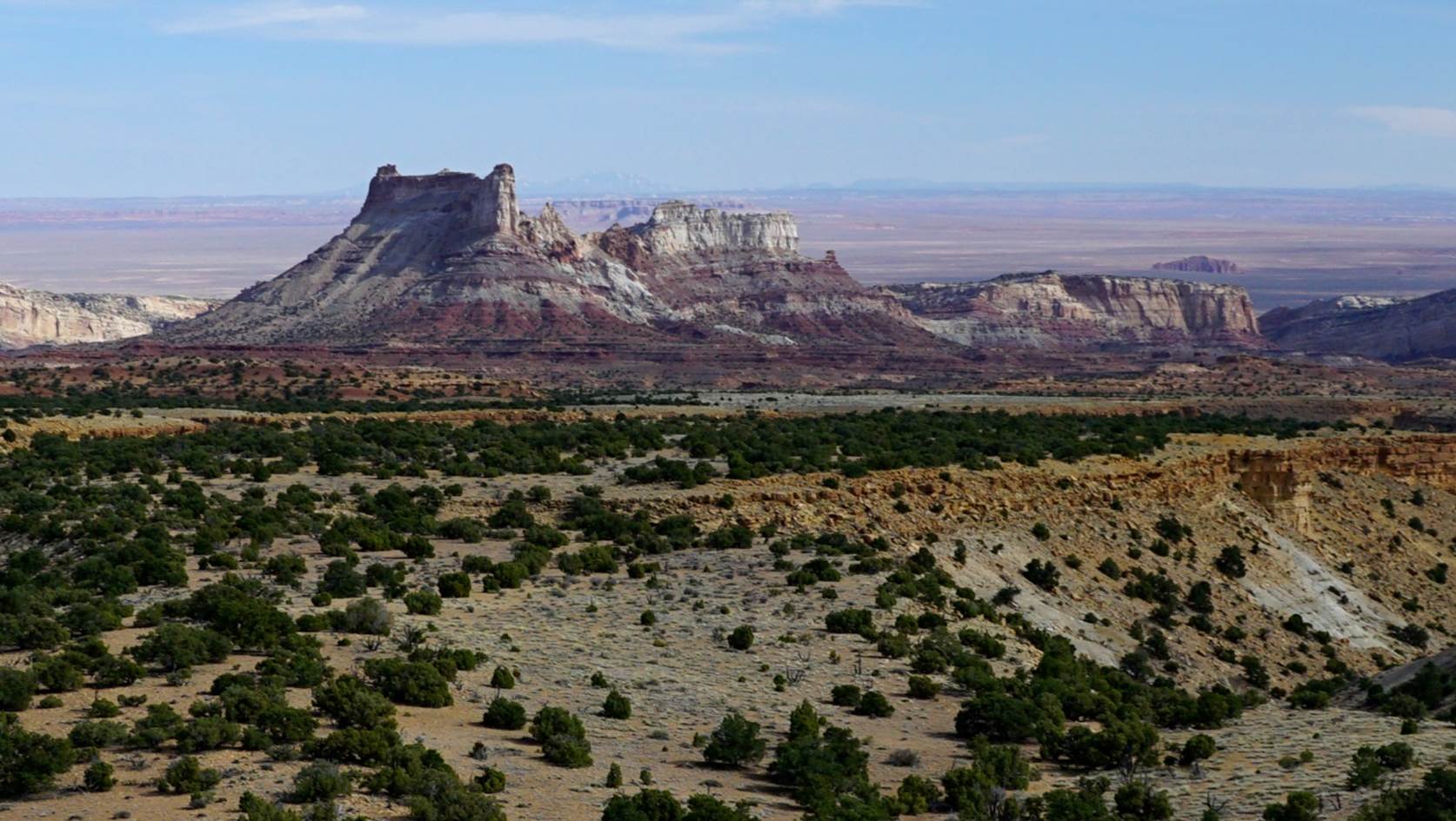
I was thinking that the way out was considerably less scenic than the way
in, until suddenly, between two hills, a giant, magnificent fortress
appeared on the horizon! What on
earth was that? But the dirt road,
annoyingly, was veering in the opposite direction.
So I backtracked, parked, and hiked up a rocky hill for the grandest view
of the whole day. It looked like
some vast ancient fantasy castle out of the Lord of the Rings or
something.
From up on the hill, I could see a hundred miles – and once again, not
one thing of humankind was visible; how rare is that in this world?
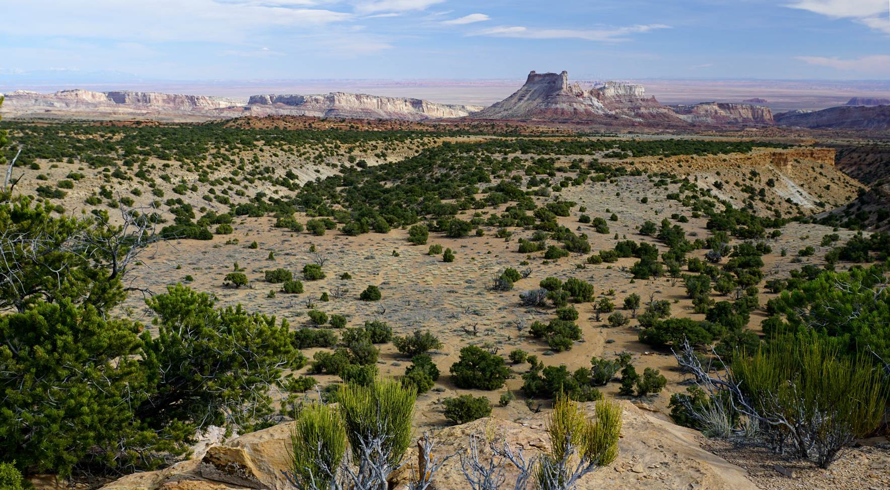
So this was Temple Mountain, I figured out.
I had heard the name, but never thought it would be anything special,
just another mountain. Apparently
the early Mormons thought it looked more like one of their temples than a
castle, but enormously larger; and it does.
I found a spot near a cliff edge where I decided I wanted to build a
house and live there forever. But
unfortunately, it is government property, so that won’t be happening.
And I am glad, because I am sure hundreds of other houses would already
be there, messing up the specialness of the place.
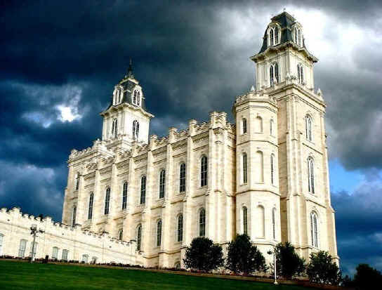
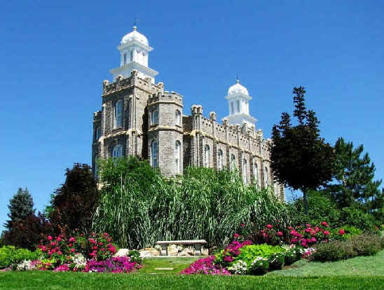
Temple
Mountain
got its name
because it is shaped
somewhat like
these two famous
temples in Utah:
Logan Temple, left
Manti
Temple,
right
Eventually, after 60 miles on dirt roads, I made it back to some
blacktop, and found myself at the entrance to Goblin Valley State Park, famous
for its weird rock formations. The
entry fee was $13, which is absurd for a state park – most national parks
aren’t even that high. I would
have done it though, except by then it was nearly closing time, the sky was
cloudy, and pictures would have turned out lousy.
So I’ll go back some day; but I knew it couldn’t match the
magnificence of what I had already seen that day, for free!
Galen
*****************************************************************************************